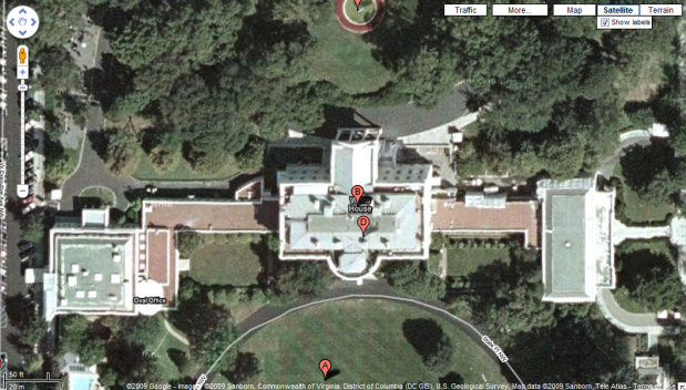
On January 18, two days before Obama was sworn into office, Google quietly made two small changes to two different residences on Google Maps and Google Earth.
During the Bush/Cheney administration, aerial views of the White House and vice president’s residence, the United State Naval Observatory, were obscured in Google Earth and Google Maps. The outlines of the White House were visible, but the roof of it and of the nearby Old Executive Office Building were replaced with featureless gray slabs. The grounds of the VP’s house were even more obscured: pixelated so much you couldn’t really tell what you were looking at.
The new hotness: The White House and the Veep’s House.

The old, blurred out and secretive images were given to Google by the U.S. Geological Survey, a government agency. The new images came from Digital Globe which is a private company.
Google of course denies that the change was political in nature and claims that it was all just part of a their “constant evaluation of various data sets available to them”. Yeah, and it just so happens that crystal clear images of the White House and Number One Observatory Circle, just happened to coincide with the ousting of one of the most secretive administrations in American History? Nice try.